
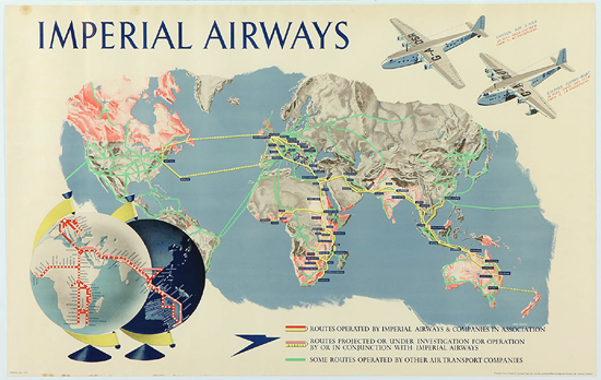
Imperial Airways Route Map (Horizontal)
1937
40 W. x 25 H. inches (101 x 63 cm)
SOLD: This poster is no longer available but please use our web site search for current stock.
Rare Route map for Imperial Airlines, the first organized UK airline with long distance flights. It existed only from 1924 to 1939 before merging with BOAC and then eventually became today's British Airways.
Imperial flew all across the British Empire as far as Australia and this map also shows the long distances flown by using 2 globes showing both sides of the world, day and night.
A wonderful detailed image and rare piece of aviation history!
Email us to inquire about this poster:
info@vintagepostersnyc.com